
Geophysical Investigation
Investigate subsurface variation where direct observations alone do not provide the complete picture.
Indirect measurements, targeted verification.
Geophysical methods provide indirect measurements of subsurface physical properties. When appropriately designed and interpreted, they can help identify spatial changes between investigation points and guide targeted verification.
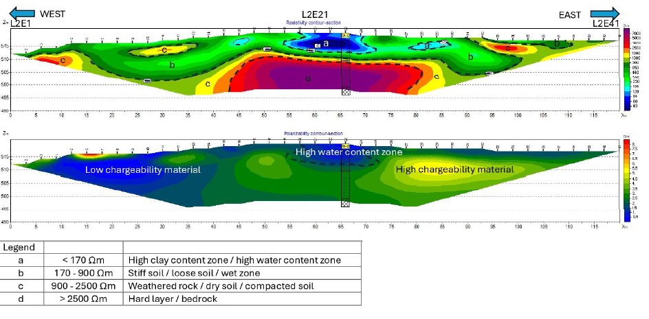
ERT — Electrical Resistivity Tomography
Imaging of subsurface resistivity variation along a survey line.
- Weathering profile
- Bedrock variation
- Groundwater-related zones
- Fractured or disturbed zones
- Potential cavities
- Subsurface anomalies
Seismic Refraction & Parallel Seismic Test
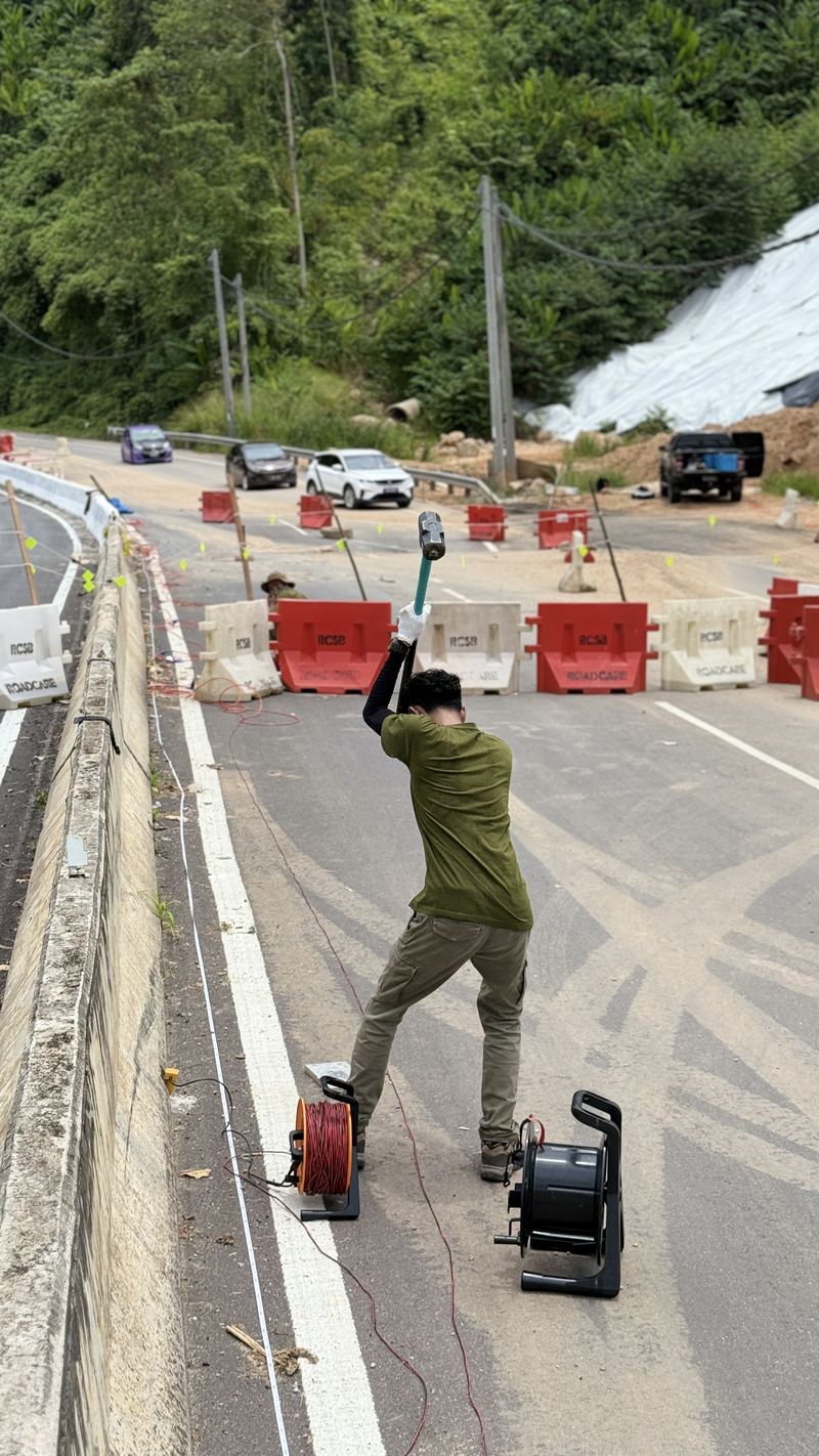
A sledgehammer source and geophone array are used to estimate subsurface stiffness and layering through seismic refraction.
The related Parallel Seismic Test estimates the depth of an existing foundation or pile where no design records are available.
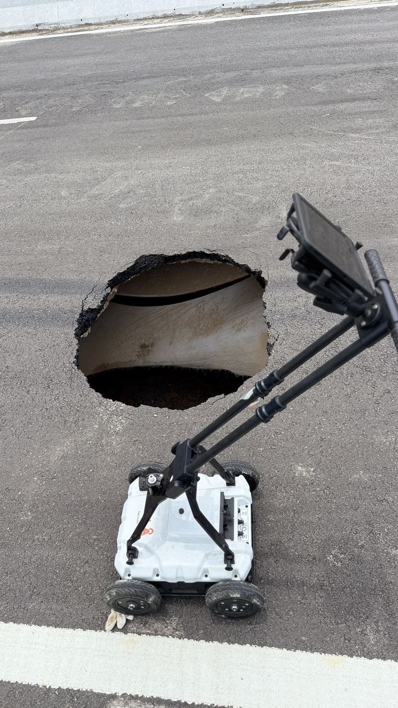
GPR — Ground Penetrating Radar
Near-surface electromagnetic imaging for suitable ground conditions.
- Buried utilities
- Near-surface structures
- Voids or anomalies
- Pavement/subsurface assessment
GPR performance is strongly influenced by soil type, moisture, clay content, depth and site conditions — feasibility should be assessed based on the site objective.
Geophysical results should not be interpreted in isolation.
Where appropriate, GEO GIS SERVICES can correlate geophysical profiles with:
Geology + Boreholes + SPT + Groundwater + Terrain + GIS
to develop a more defensible interpretation.
Discuss a geophysical survey.
Tell us what you need to investigate and we'll recommend an appropriate method or combination of methods.